Digby
Digby is a rural village in western Victoria, 45 km west of Hamilton. It is situated at the intersection of minor roads between Hamilton and Dartmoor and between Casterton and Portland.
The Digby area was travelled by the New South Wales Surveyor General Thomas Mitchell, during his Australia Felix expedition in 1836. He named the Stokes River, which flows north of Digby and enters the Glenelg River.
Stokes River was also known as Emu Creek, and a pastoral run of that name was taken up in 1842. The run’s proprietor also opened the Woolpack Inn in 1843 at the future site of Digby. The locality was well timbered sheep grazing land and attracted farm settlers during the late 1850s. An Anglican church (1861) and a school (1864) were opened, and there were three hotels. Timber cutting was an important industry during the 1860s. By the early 1880s Digby had a mechanics’ institute and also a Wesleyan church.
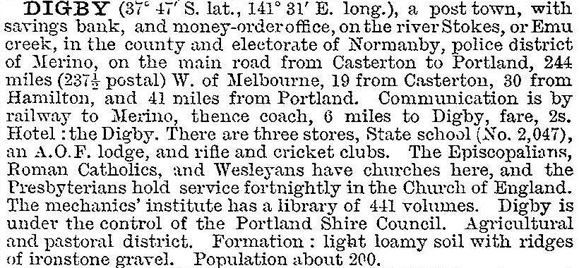
In 1903 Digby was described in the Australian handbook:

During the years after World War I soldier settlement increased Digby’s populations to over 300 people. In the 1960s however, the population fell, and in 1969 there were only 20 pupils in the school.
Although at a road intersection Digby is not on a highway, and the village fulfils a purely local role. It has a recreation reserve, two churches, a general store, a hall and a hotel. The school has closed.
Digby’s census populations have been:
| area | census date | population |
|---|---|---|
| Digby | 1861 | 179 |
| 1901 | 224 | |
| 1921 | 345 | |
| 1933 | 245 | |
| 1954 | 262 | |
| 1961 | 254 | |
| Digby and environs | 2011 | 222 |
At the 2011 census farming accounted for 44% of employment. A quarter of the residents who expressed a religious affiliation nominated the Uniting church, compared with 4.7% in Victoria (2011 census).
Further Reading
Gwen Bennett, Watering holes of the west (hotels etc Heywood Shire), the author, 1997


