Durham Lead
Durham Lead (also known as Durham, 1870s) was a mining township 15 km south of Ballarat. It was one of several mining centres along the main mining lead running south of Ballarat, generally along the valley formed by the Yarowee or Leigh River.
Gold was discovered at Durham Lead in March 1857, and within a few months a hotel building was transported to the emerging township. Two large companies mined the area – the Duke of Northumberland Goldmining Company and the Pioneer Goldmining Company. A few kilometres south another township, Garibaldi, grew around mines along the gold lead. Durham Lead township included a post office, a store, a draper and a butcher. There were no flour mill or other industries. Schools were provided at Garibaldi (1879) and at Green Hill (the name of a lead north-east of Durham Lead).
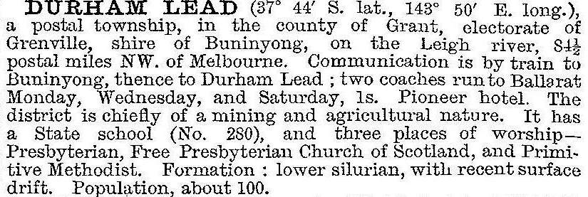
Seepage from the water table troubled the mining companies, and most were substantially scaled down or ended by the 1880s. In 1903 the Australian handbook described Durham Lead:

Durham Lead was described in the Victorian municipal directory in 1933 as having two churches and a store, but by 1960 its description was limited to being an agricultural district.
The Garibaldi and Green Hill schools had closed in 1943 and 1945, although the building at Garibaldi has been kept as a community centre. Durham Lead, however, is identifiable by a mullock heap and a quadrilateral street outline off the Mount Mercer Road.
Durham Lead’s census populations have been:
| Census date | Population |
|---|---|
| 1871 | 723 |
| 1911 | 247 |
| 1961 | 53 |
| 2011* | 400 |
*and environs
Further Reading
Peter M. Griffiths, Three times blest: a history of Buninyong and district 1837-1901, Buninyong, 1988


