Granya
Granya, a rural village and former gold mining town in north-east Victoria, is 40 km east of Wodonga and 5 km south of the Murray River where it forms the eastern arm of Lake Hume.
The origin of the name is uncertain, but is surmised to have been from an Aboriginal expression. Mount Granya (870 metres) is about 8 km south-west. Before there was anything other than rudimentary pastoral occupation, Bailliere’s Victorian gazetteer (1865) described the Granya ranges as exceedingly rugged and precipitous, densely scrubbed and heavily timbered. They were snow covered for part of the year.
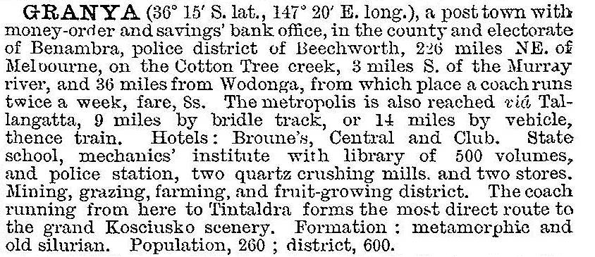
About 20 km west of Granya gold was found at Bethanga in 1867, but it was another 11 years before intermittent prospecting led to sustained mining at Granya. Mostly it was sluicing on Cottontree Creek, the first name given to Granya. In 1879 a township on Cottontree Creek was surveyed and named Granya. In 1880 a school was opened. A government battery crushed the ore from several mines, and the Granya mine continued until 1905. In 1903 Granya was described in the Australian handbook:

Mining was resumed in the 1930s and continued for about 10 years. Anglican and Catholic churches were recorded in the Victorian municipal directory (1938).
The undulating land at Granya supports grazing, and there are ranges to the east and west. They mainly comprise the Mount Lawson and Mount Granya State Parks respectively. The Mount Granya Park includes the Granya Falls (3 km west of Granya) and the summit on its western boundary. The Park’s area is 61 sq km.
Granya’s school was closed in 1994, and a hall, a history museum, a CFA station and a recreation reserve continue as the community’s centres. Granya’s census populations have been:
| area | census date | population |
|---|---|---|
| Granya | 1891 | 209 |
| 1911 | 236 | |
| 1933 | 170 | |
| 1961 | 116 | |
| Granya and environs | 2006 | 150 |
Granya was not a separate census area in 2011.


