Tintaldra
Tintaldra is a rural locality in north-east Victoria, situated on the Murray River. It is 65 km east of Lake Hume and 17 km north of Corryong.
In 1837 the Tintaldra pastoral run was taken up by Rowland Shelley, a pastoralist from Tumut, New South Wales. It is thought that the name derived from an Aboriginal word describing a young man.
Tintaldra was a remote area set in deep ranges, but it later became a crossing place on the Murray River. The first means of crossing was a punt which was replaced by a bridge in 1892. In 1893 the Victorian municipal directory noted that Tintaldra was beautifully situated, but the population was scanty and the land was held in large estates. Despite the small population a school was opened in 1890 (in a homestead because an owner refused to part with any land) and in 1893 the school was put on a firmer footing when land was found next to the bridge.
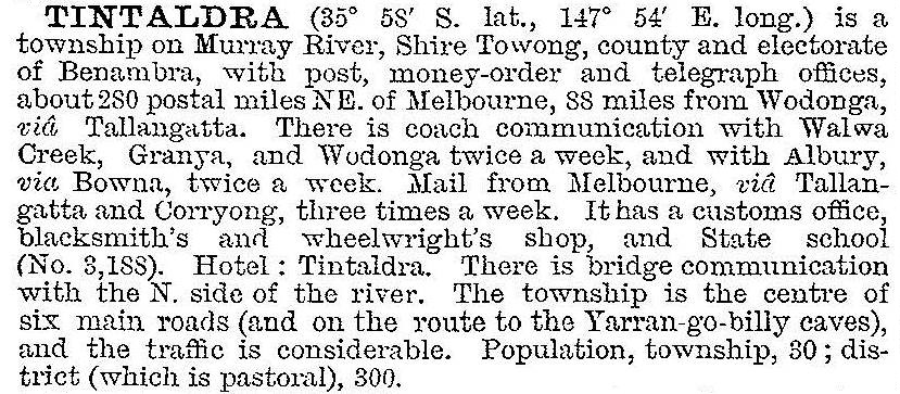
In 1903 Tintaldra was described in the Australian handbook:

The remote Tintaldra customs house handled goods to and from Tumut and the New South Wales tablelands. The end of State border duties in 1901 ended Tintaldra’s role in interstate or regional commerce.
In the early 1920s some of the large properties were subdivided for soldier settlement farms. Good dairying land was found along the Cudgewa Creek, west of Tintaldra, and the district maintained a stable rural population until the 1960s. The school was closed in 1951 when the Corryong Consolidated was opened.
Tintaldra has a hotel, a hall, a post office and a recreation reserve. The store (1864) and post office, and a bakery (1928) in the backyard, are heritage listed.
Tintaldra’s census populations have been:
| area | census date | population |
|---|---|---|
| Tintaldra | 1871 | 17 |
| 1891 | 96 | |
| 1921 | 143 | |
| 1933 | 209 | |
| 1961 | 141 | |
| Tintaldra and environs | 2006 | 203 |
| 2011 | not published |
Further Reading
Betty Walton, Tintaldra, first settled 1837: a brief history, the author, nd


