Cardigan and Cardigan Village
Cardigan and Cardigan Village are on the Western Highway, 11 km and 14 km respectively north-west of Ballarat.
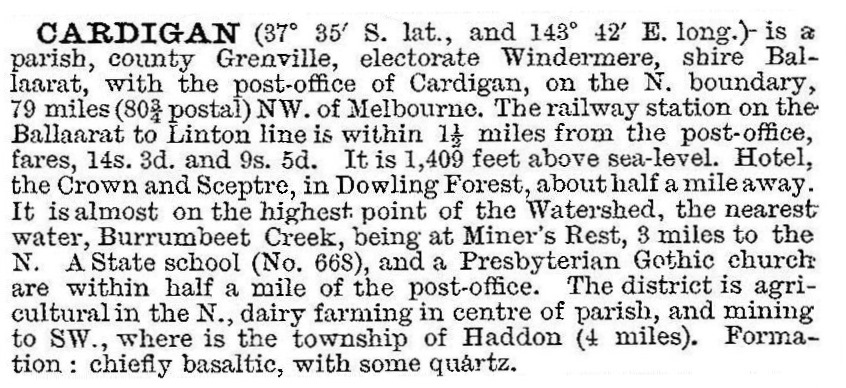
Cardigan was named after Lord Cardigan, Commander of the Light Brigade in the Crimean War. Situated in an agricultural district, Cardigan at various times had a school (1860), a hotel and a Presbyterian church. It was described in the 1903 Australian handbook:

Cardigan Village is a satellite residential subdivision formed in the early 1980s. It was stated to have a projected population of several thousand people. There is also the Windermere hotel on the Old Western Highway.
A controversial 200 hectare development site to include 3200 houses, recreational facilities, hotel and shops in Cardigan was identified in 2010.
Census figures have been:
| census date | population | ||
|---|---|---|---|
| Cardigan | Cardigan Village | Cardigan and environs | |
| 1911 | 162 | ||
| 1986 | 210 | ||
| 1996 | 228 | ||
| 2006 | 340 | 703 | |
| 2011 | 506 | 647 | |
Further Reading
State School No 668 Cardigan: centenary celebrations 1860-1960
Windermere entry


