Crossley
Crossley is a rural locality in western Victoria, 12 km north-east of Port Fairy. It lies on land nourished by the volcanic soils of the Tower Hill caldera, and is 2 km west of the Tower Hill lake.
Crossley became densely settled by farmers drawn to the fertile soil in the 1850s-60s. A National school was opened in the area in 1867, and a Catholic school (mainly for Irish settlers) opened at about the same time. St Brigid's school's enrolments were so successful that a subsequent Government school (1878) closed in 1892.
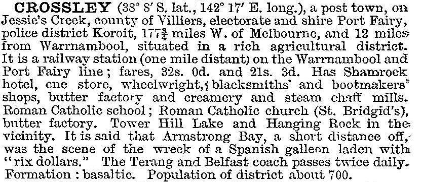
In 1903 Crossley was described in the Australian handbook:

(The reference to a Spanish galleon probably concerned the Mahogany Ship, thought to be of Portugese origin).
The building of the Princes Highway caused traffic to bypass Crossley, leading to the closure of its store and the hotel (1969). In 1972 the Catholic school also closed. The farmland nevertheless supports grazing, dairying and potato and onion growing. Infrequent services were held at the Catholic church until its closure in 2006. Local residents formed Friends of St Brigid's and purchased the church building after it was decommissioned. Crossley's census populations have been:
| Census Date | Population |
|---|---|
| 1871 | 269 |
| 1911 | 471 |
| 1947 | 234 |
| 1961 | 192 |
| 2011 | 351* |
*includes Toolong
Further Reading
Pamela M. Marriott, A shamrock beneath the Southern Cross: an history of the Shire of Belfast, Warrnambool, 1988


