Indigo
Indigo is a rural locality and a former gold mining village in north-east Victoria, 8 km south-east of Rutherglen. It was one of three villages located at intervals of about 1 km on the Indigo gold lead. The others were Cornishtown and Christmastown.
The Indigo gold lead was opened up in 1859. Both the lead and the village were named after the Indigo Creek. It is thought that the creek was named after native Indigofera shrubs growing in its vicinity. (Two of the world's 700 Indigofera species are the source of indigo dye in the tropics and the Middle East.)
In 1865 Bailliere's Victorian gazetteer described Indigo as a postal and road board town situated among several gold diggings. There was also an Indigo mining division in which there were 1634 miners, mainly working alluvial claims. Over one third were Chinese.
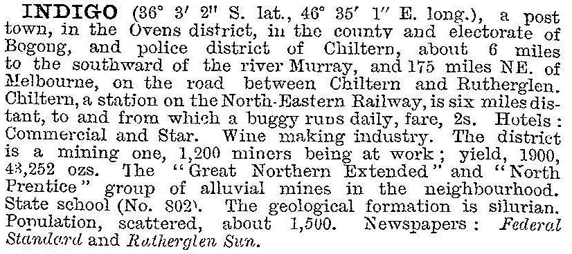
By the turn of the century the name Cornishtown seems to have taken precedence over Indigo in municipal guides, perhaps because the school and the hotel were there. The 1903 Australian handbook described Indigo:

By the 1930s Indigo was described as a farming area. Indigo village was previously also known as Mount Pleasant.
Indigo's census populations were:
| census date | population |
|---|---|
| 1891 | 224 |
| 1911 | 358 |
| 1961 | 51 |
Further Reading
Robert W.P. Ashley, History of the Shire of Chiltern, 1974


