Lillydale Shire
Lillydale Shire (1872-1994), an area of 397.5 sq km, was centred on the Yarra valley east of Melbourne. Its main town, Lilydale, is 35 km east of central Melbourne, on the Maroondah Highway.
For an explanation of the origin and spellings of the names (with one or two Ls) see the entry on Lilydale.
Lillydale road district was created in 1856 and the shire was proclaimed on 16 February 1872. Its area was 580 sq km. In 1924 Ringwood borough was severed from Lillydale shire and in 1961 Croydon shire was severed. Both were burgeoning urban settlements.
Before the severances Lilydale township was the market centre for the Yarra valley with its rich alluvial flats. There was fruit growing in the hilly eastern parts. Ringwood and Croydon were smaller market towns for fruit, vegetables and dairy produce. All had agricultural shows. The railway from Melbourne to Lilydale (1882) had branches from Lilydale to Healesville (1889-1981) and Warburton (1901-65). The former serviced the Yarra flats and the latter orchard areas such as Wandin and Woori Yallock. There were also heavily timbered areas in the Dandenong Ranges, as the shire included Mount Dandenong (633 m), part of Olinda and the watershed of the Silvan reservoir.
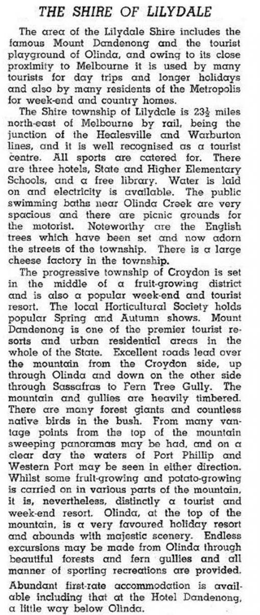
In 1946 Lillydale (Lilydale) shire was described in the Australian blue book:

By 1961 Lillydale shire’s population (after Croydon had been excised) was about 18,000, 5000 more than at the end of World War II. Within 10 years the population doubled, and in another 15 years doubled again. Agricultural holdings declined in both number and total area, and farm outputs changed:
| Year | Holdings | Holdings’ area | Dairy cattle | Beef cattle | Pigs | Sheep | Vineyards |
|---|---|---|---|---|---|---|---|
| ha | ha | ||||||
| 1974-75 | 848 | 25,363 | 3088 | 14,510 | 11,008 | 5856 | 36 |
| 1992-93 | 290 | 13,736 | 2166 | 8821 | 13,566 | 3085 | 232 |
Vineyards along the Melba Highway and elsewhere proliferated, bringing a new kind of tourism in addition to the sight-seers at Mount Dandenong and Olinda.
Mooroolbark, south and east of Lilydale, became the shire’s biggest suburb with five State primary schools and a population in 1991 bigger than the whole shire 35 years before.
Mooroolbark is within easy reach of Mount Dandenong’s television transmission towers. On the other side of the range there are the volcanic Silvan basalt soils, home to fruit growing, cut flowers and other horticulture. Out of reach of railways, the Silvan, Monbulk and Wandin areas have avoided spectacular urbanisation; Silvan hosts annual flower farm festivals.
In 1994 most of Lillydale shire was united with all of Healesville and Upper Yarra shires and most of Sherbrooke shire to form Yarra Ranges shire. Lillydale shire’s census populations were:
| census date | population |
|---|---|
| 1881 | 2543 |
| 1891 | 4646 |
| 1901 | 5348 |
| 1911 | 6329 |
| 1921 | 9409 |
| 1933 | 9855 |
| 1947 | 13,809 |
| 1954 | 16,619 |
| 1961 | 18,254* |
| 1966 | 24,173 |
| 1971 | 36,162 |
| 1976 | 50,858 |
| 1981 | 62,077 |
| 1986 | 74,000 |
| 1991 | 82,600 |
*Croydon excised
Further Reading
Marian Aveling, Lillydale: the Billanook country 1837-1972, 1972
James Rouget, Shire of Lillydale, past and present, 1837-1923, St Kilda, 1924
John Paterson et al, Lillydale rural policy review, South Melbourne, 1980
Shire of Lillydale agricultural profile, Lilydale, 1995
Peter Baddeley, Billanook country revisited: a history of the shire of Lillydale, 1972-1994, Lilydale, 1996
Chirnside Park, Coldstream, Gruyere, Kalorama, Kilsyth, Monbulk, Montrose, Mooroolbark, Mount Dandenong, Lilydale, Mount Evelyn, Silvan, Seville, Wandin, Wonga Park and Yering entries


