Morrisons
Morrisons is a rural locality 75 km west of Melbourne and 8 km north-east of Meredith. It is at the headwaters of the Moorabool River where it is joined by several creeks. The river is steeply banked, but the surrounding land is undulating and used for grazing.
Morrisons was named after Hugh Morrison, the proprietor of two pastoral runs in the area during 1854-66.
Gold was found at one of the Moorabool tributaries, Dolly's Creek, in 1856, and more was found under basalt on the east side of the river in 1861. A school was opened at Dolly's Creek in 1859, and an Anglican school at Morrisons in 1861. The Dolly's Creek school became the one which served the district, being renamed Morrisons in 1933 and continuing until 1951.
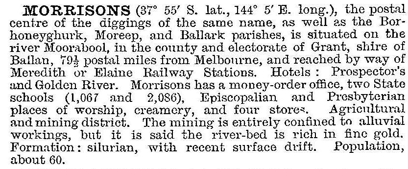
Morrisons has a ford over the Moorabool River and is the junction of several local roads. It had several hotels at the height of its mining activity. The township was along the edge of the river, overlooked by a heap of tailings from the Red Jacket mine. In 1903 the Australian handbook described Morrisons:

Upon the end of mining Morrisons became reliant on grazing and dairying. The local population subscribed to the removal of the weatherboard Anglican church in 1924 to Lethbridge and its replacement by a large brick church. The local football team was the district premier in 1933.
At about the time of the school closure in 1951 two of the three churches closed. Morrisons now has the Anglican church and a cemetery. Its census populations have been:
| Census Date | Population |
|---|---|
| 1871 | 317 |
| 1911 | 237 |
| 1961 | 52 |
| 2011 | 168* |
*and environs
Further Reading
A pictorial history of the Shire of Ballan, Ballan, 1988


