Sarsfield
The farming district of Sarsfield lies about 13 km north-east of Bairnsdale in East Gippsland. The Nicholson River flows from north to south through the fertile valley and the Omeo Highway passes through the area.
The Sarsfield district was part of the territory of the Brabralung tribe but by 1840, when Angus McMillan crossed the Nicholson River, their numbers had already dwindled. Lucknow pastoral run claimed the area west of the river in 1842 and Mibost run the area east of the river in 1855.
Gold was discovered in the Nicholson in 1854, and an accommodation house and hotel was built near the river crossing. The area was apparently named after General Patrick Sarsfield, a relative of the publican. Boats sailed up the river to the inn, bringing miners and supplies. When a bridge was constructed in 1859, a township was surveyed but few blocks were sold. However by the 1870s, much of the land in the district was settled. Mixed farming became the main activity, with crops of maize, chicory, tobacco and hops. A sawmill worked at Sarsfield and later sleepers were cut from the surrounding bush.
Another hotel was established near the new bridge built in 1871 and a school opened in 1873. When the Shire of Tambo was proclaimed in 1882, the Nicholson River formed a municipal boundary. By the late 1890s, the community also had a Presbyterian church and a hall. The population was boosted by a village settlement established in 1893. Although small, 11 blocks on 33 acres, the settlers grew vegetables, kept poultry and pigs and were able to find employment on surrounding farms. A creamery was established in the 1890s, encouraging dairying.
Sarsfield was a coach staging post on the route between Bairnsdale and Omeo, but up to the late 1890s the river provided a major means of transport. Maize and ti tree poles for the hop fields near Bairnsdale were shipped by steamer. Stone was quarried in the Sarsfield district for construction of the artificial entrance to the Gippsland Lakes. The Granite Rock Quarry, established in 1894, transported rock by tramline to the river. However by the late 1890s, hop crops declined due to insect damage, the rivers were silted and road transport had improved, so the river trade declined.
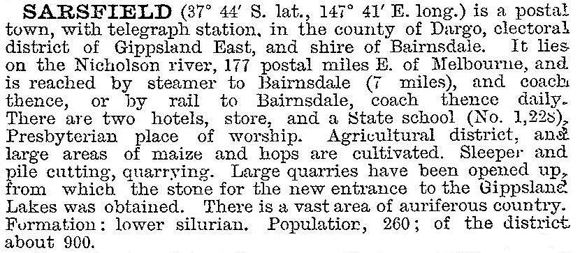
The Australian handbook described the settlement in 1903:

By the 1920s maize cropping, dairying and pig raising continued to be widespread, with some pea and bean crops, poultry farming and fruit growing. By the 1940s several large dairy herds supplied cream to the milk factory at Bairnsdale. Dairying flourished in the 1950s, with large areas of bush being cleared but by the 1960s a downturn in the industry favoured beef grazing.
During the 1950s Australian Paper Manufacturers obtained pulpwood from the area, mainly stringy bark from private properties. The company purchased a large area of bush and established a depot at Sarsfield but sold again in the 1960s. Pulpwood cutting ceased, but railway sleepers and power poles were also cut from the forest. After intermittent operation, the quarry began working again in the late 1980s, supplying road aggregate. The rock was also used for decorative purposes, being of an unusual soft pink colour.
Floods periodically afflict the valley, the worst being in 1893 and 1935. Bushfires also ravaged the district in 1939 and 1965, and a severe drought in the late 1960s caused the Nicholson River to cease flowing in 1968.
From the 1970s the district experienced population growth. Small allotments were subdivided and new homes also built on old subdivisions. Most of the new residents commute to Bairnsdale, and the township continued to decline. A Catholic church was built in 1922, but was moved to Paynesville in 1952 and the Presbyterian church (1897) was destroyed in the 1965 bushfire. The remaining hotel closed in 1965 and the school in 1992. A recreation reserve serves local sporting teams.
Census populations for the Sarsfield district have been:
| area | census date | population |
|---|---|---|
| Sarsfield | 1871 | 98 |
| 1901 | 182 | |
| 1911 | 319 | |
| 1933 | 217 | |
| 1954 | 140 | |
| Sarsfield and environs | 2006 | 617 |
| 2011 | 568 |
Further Reading
Sarsfield – a rural community, Sarsfield Community Bicentennial Committee, 1988


