Tambo Shire
Tambo Shire (1882-1994) was created on 6 January 1882, by severance from Bairnsdale shire. It was named after the Tambo River which rises near Mount Tambo (1431 metres), east of Benambra, Gippsland. Within a few months of its creation Tambo shire was reduced by the excision of Orbost shire, but in 1913 the Cunninghame (Lakes Entrance) district was taken from Orbost shire and put in Tambo. The shire’s area was 3507 sq km.
The name Tambo is thought to derive from an Aboriginal word meaning fish.
Tambo River’s headwaters are about 30 km from the New South Wales border, and the shire’s boundaries reached the state border. Its western boundary was the Nicholson River and a northwards prolongation, and most of its eastern border was the Snowy River. About 2000 sq km of the shire was not farmed, and most of that was forested and alpine in the north.
The defining feature of the shire was the Gippsland Lakes in the south, fed by the Nicholson and Tambo Rivers, and Lake Tyers fed by Boggy Creek. Both of the rivers had moist flats, suitable for dairying and agriculture. The Tambo River was navigable downstream from Bruthen, entering Lake King through its silt jetties. There was a profitable two way trade through the Gippsland Lakes, including produce destined for Melbourne.
In 1916 the Gippsland railway was extended from Bairnsdale via Bruthen to Orbost. Lakes Entrance was bypassed, and access to there relied on coastal ships and the unmade Gippsland road (now the Princes Highway). Visitors to the Buchan caves had to take a coach from Lakes Entrance. The villages of Metung, Paynesville and Swan Reach each had about 100 people in 1900, and Cunninghame had about 500. Bruthen was the shire’s headquarters, which remained the position although Cunninghame had more people.
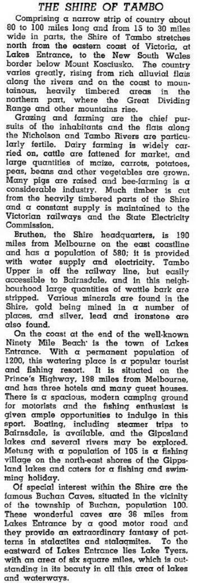
By the 1930s population growth in the Lakes area was outpacing the population in Tambo’s agricultural districts. In 1946 the shire gave the Australian blue book a description of itself, emphasising its productive farming and its touristic attractions:

In 1954 Lakes Entrance had half the shire’s population. Within 30 years Paynesville had about one fifth, and the smaller waterside towns of Metung and Swan Reach were also growing. Tambo shire, from the slopes of Kosciuszko to the sea, was concentrating on the coastal edge. The railway from Bairnsdale to Orbost was closed in 1987 but visitors to Lakes Entrance had been coming by road for decades, even if only by coach from Bairnsdale station. The shire’s farm activity in 1994 included 37,500 meat cattle, 2100 dairy cattle, 41,200 sheep and 14,150 lambs.
In 1994 Tambo shire was united with Bairnsdale city, Orbost and Omeo shires, most of Bairnsdale shire and part of Rosedale shire to form East Gippsland shire.
Tambo shire’s census populations were:
| census date | population |
|---|---|
| 1891 | 2646 |
| 1911 | 2485 |
| 1921 | 4228* |
| 1954 | 5085 |
| 1971 | 5888 |
| 1976 | 6530 |
| 1981 | 7260 |
| 1986 | 9230 |
| 1991 | 10,540 |
* Lakes Entrance added
Further Reading
J.D. Adams, The Tambo Shire centenary history, Bruthen, 1981
Bruthen, Buchan, Gippsland Lakes, Johnsonville, Kalimna, Lake Tyers Beach, Lakes Entrance, Metung, Nowa Nowa, Nungurner, Sarsfield and Swan Reach entries


