Beveridge
Beveridge is a village on the Hume Freeway, 37 km north of central Melbourne. It was named after Andrew Beveridge’s hotel (1839) on the Sydney Road.
In 1852 a township reserve was surveyed and named after the nearby pastoral station, Mercer Vale. The name did not take, as the area was better known by Beveridge’s hotel.
Beveridge became the administrative centre for the Donnybrook and Wallan Wallan Road Board (1865) and the Merriang shire (1871-1915). The shire-hall site has since been obliterated by the Hume Freeway. There are, however, two historic buildings: the farm house built by John Kelly (1869), the probable birthplace of his son, the outlaw Ned Kelly, and the bluestone Gothic former Catholic church (1862). They are on the Victorian and Australian historic buildings registers respectively.
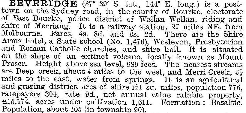
In 1903 Beveridge was described in the Australian handbook:

About 2 km north of Beveridge is the volcanic cone of Mount Fraser. Its smooth slopes are scarred by a scoria quarry. The village, however, remained little further developed than it was one hundred years before, but that changed with the opening of a housing estate west of the freeway in the 2000s. Beveridge primary school had 207 pupils in 2014.
Beveridge’s census populations have been:
| area | census date | population |
|---|---|---|
| Beveridge | 1861 | 45 |
| 1881 | 60 | |
| 1891 | 105 | |
| 1911 | 103 | |
| 1933 | 149 | |
| 1947 | 113 | |
| 1961 | 147 | |
| 2006 | 341 | |
| Beveridge and environs | 2011 | 872 |
Further Reading
J.W. Payne, The history of Beveridge, Kilmore, 1974


